


Chandrashila Trek 2024 | Chandrashila Trek Guide 2024 | Chandrashila Trek Cost | Best Time To Visit Chandrashila | Chandrashila Trek itinerary | Chandrashila Trek Tips | Deoriatal Chandrashila Trek | Tungnath Chandrashila Trek | History | Timings
History of Chandrashila
Situated at a distance of about 1.5 km from Tungnath, known as the Third Kedar in Uttarakhand, Chandrashila is believed to have mythological significance dating back to the Ramayana period and even older. Chandrashila located in the Tungnath mountain has not only mythological significance. Rather Chandrashila is considered to be one of the most famous trekking destinations in Uttarakhand.
Almost every year, trekkers from different parts of the country and the world keep coming here to complete the Chandrashila Summit. I believe that we should go anywhere to roam, whether it is a plain area, a desert area, a sea area or a snowy mountain. All the tourist places in the world have some history. And if we go there knowing the history of that place. So before going to that place, we feel very attached to that place.
Therefore, before knowing about the Chandrashila trek, it is very important to know about the mythological significance of this magnificent place. King Daksha Prajapati had 27 girls. Chandrama (Moon) was very much in love with a girl named Rohini, when they came to know about this, King Daksha Prajapati cursed the Chandrama (Moon). Chandrama (Moon) gets tuberculosis due to the curse of King Daksha Prajapati.
To get rid of Tuberculosis, Chandrama (Moon) comes to this place situated near Tungnath and performs hard austerities to please Lord Shiva. Pleased with penance, Lord Shiva blesses the Chandrama (Moon) to be free from tuberculosis. It is said that this place is called Chandrashila due to the harsh penance performed by the Chandrama (Moon). A very small temple is also built on the peak of Chandrashila.
After the completion of the Chandrashila Summit, all the trekkers who come here definitely visit this temple. According to a legend associated with the Ramayana period, Lord Rama also did penance at this place to get rid of the crime of killing Brahmins after killing Ravana.
Geography of Chandrashila

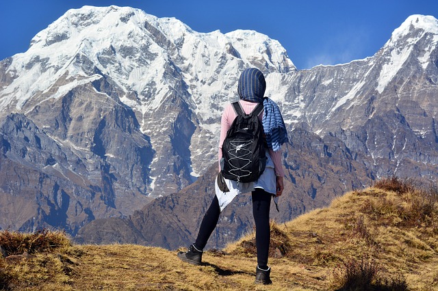
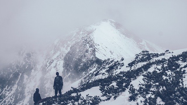
One of the most famous trekking destinations in Uttarakhand, Chandrashila Peak is 4000 meters (13,120 ft) above sea level. Situated near Chandrashila, Tungnath has an elevation of 3680 meters above sea level. The height of Chopta from where the Chandrashila trek starts is 2680 meters (8793 ft) above sea level.
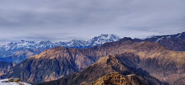
Chandrashila Peak, located at a distance of 5.5 km from Chopta, shows several major Himalayan mountain ranges, of which Nandadevi, Chaukhamba, Bugyal, Trishul, Kedar and Bandarpunch are considered prominent.
Chandrashila Trek
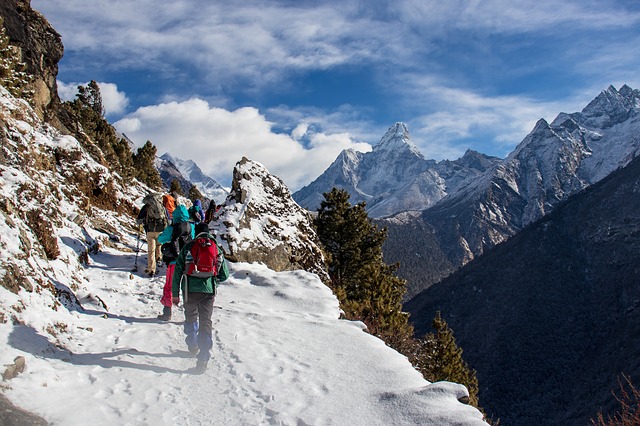
There are two major ways to reach the peak of Chandrashila. First of all, you can reach the peak of Chandrashila from Chopta via Tungnath. This is the shortest trek to reach the peak of Chandrashila which is just 5.5 kilometres. This trek is closed due to excessive snowfall during the winter season. This trek leading to Chandrashila is known as Tunganath Chandrashila Trek.
The second trek leading to Chandrashila is used throughout the year and almost all the tracking organizations use it. This trek is very famous as the Deoriatal Chandrashila Trek. The total distance of the Deoriatal Chandrashila trek is 27 km, which starts from the village of Sari, 12 kilometres from Ukhimath.
Tungnath Chandrashila Trek
The length of the Tungnath Chandrashila trek, starting from Chopta, is only 5.5 kilometres. When you start your trek from Chopta, you reach Tungnath first. The track from Chopta to Tungnath is 04 kilometres long and the entire road is paved with the help of stones. Due to this, these 04 kilometres from Chopta to Tungnath are completed very easily.
After reaching Tungnath, the 1.5-km stretch of Chandrashila remains, which is a full steep climb. This 1.5-kilometre walkway is a little tiring. But when you reach the summit of Chandrashila, then all your tiredness is completely eradicated due to the scenery seen from here.
The distance between Chopta to Tungnath is 4 kilometres and the distance between Tungnath to Chandrashila is about 1.5 kilometres. You can complete the Tungnath Chandrashila trek in a few hours. The best part of this track is that to complete this track you do not need any kind of trekking guide or contact any tracking organization.
All you have to do is to reach Chopta and then start your trek from Chopta, and you will be at the summit of Chandrashila in a few hours. Due to heavy snowfall in the winter season, many feet of snow in Chopta freeze, due to which the track of Tungnath Chandrashila is closed.
In the winter season, all trekkers complete the track of the Chandrashila Peak by way of the Deoriatal Chandrashila trek. The total distance of the Tungnath Chandrashila trek is around 11 km and this trek is considered to be one of the easiest and medium-range treks of Uttarakhand.
If you start your journey from Delhi, then you can complete this trek very easily in 5-6 days. The trek is closed due to heavy snowfall from January to February and March.
Deoriatal Chandrashila Trek

The Deoriatal Chandrashila trek is 27 km in length starting from the village of Sari, 12 km from Ukhimath. The total duration to complete this trek is 03 days. If you are trekking for the first time at Deoriatal Chandrashila and you are not a professional trekker then you must contact a good tracking organization to complete this trek. All the trekking organizations in India use the Deoriatal Chandrashila trek to reach the summit of Chandrashila.
Its biggest reason is that through this route, you can reach Chandrashila anytime in the whole year. Second, while trekking, you pass through the magnificent forests of Kedarnath Wildlife Sanctuary. Apart from this, if you trek to the summit of Chandrashila by this route, then you also get a proper tracking experience. This trek is just a bit more expensive than the Tungnath Chandrashila trek.
Nearly all tracking organizations can charge you from INR 8000 / – to INR 10000 / – for the Deoriatal Chandrashila trek. This fee, these people include the fee to travel from Delhi to Chandrashila and from Chandrashila to Delhi (some trekking organizations plan your entire trek from Haridwar and Rishikesh instead of Delhi).
In the package of Deoriatal Chandrashila trek, the tracking organization includes all the tools used for your shopping, eating and tracking. You can trek Chandrashila all year round by the way of the Deoriatal Chandrashila trek. But in January and February, 8-10 feet of snow accumulates in Chandrashila. Because of this, this trek in these two months is not considered safe at all.
Deoriatal Chandrashila Trek itinerary

The Deoriatal Chandrashila trek, starting from Sari village, has a total travel schedule of 03 days. If you are starting your journey from Rishikesh, then you have to reach Rudraprayag from Rishikesh first (via Devprayag and Srinagar). It takes around 05 hours to reach Rudraprayag from Rishikesh by bus. After reaching Rudraprayag, you have to reach Ukhimath, for which you may take another 3 hours.
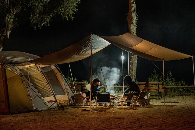
From Ukhimath, you can reach the village of Sari in half an hour. Your Deoriatal Chandrashila trek starts from Sari village. When you start your trek from the village of Sari on the first day, you trek only 02 kilometres to reach Deoriatal, and you have to spend the night in a tent near Deoriatal Lake. The next morning you wake up early and have to trek to your next destination, Baniyakund.
The walking distance from Deoriatal to Baniyakund is about 17 kilometres. It may take you more than 10 hours to complete this distance. From Baniyakund Kund, you can reach Chopta by bus and taxi, and also on foot, now it depends on you, how to reach Chopta. This is the third and last day of your Deoriatal Chandrashila trek. Chandrashila Peak is located at a distance of about 08 km from Baniyakund.
Trek from Baniyakund to Chandrashila will be the most difficult part of your entire trek. During the entire trek of 08 kilometres, you will have to climb steeply at many places which can be quite exhausting. After reaching Chandrashila Peak, you experience a different kind of achievement.
Apart from the winter season, when you come back down from the peak of Chandrashila, you can reach Rishikesh with the help of a bus and taxi from Chopta. And if you are trekking Chandrashila in winter, you have to trek back to Baniyakund or Sari village and come down and then from here, you can reach Rishikesh with the help of a bus and a taxi.
Note: – If you are trekking Chandrashila with the help of a trekking organization, then you must know about all the facilities offered by them. You should also know in advance what your peak and drop points will be. Also, find out about what medical facility will be available for you during the trek. The most important thing is that if you cancel your trip, then what will be the refund policy, you should also know about it.
Deoria Tal Chandrakala track Map
Day 1 – Sari to Deoriatal 02 km
Day 2 – Deoriatal to Baniyakund 17 km
Third day – Baniyakund to Chandrashila 08 km
Route :- Sari – Deoriatal – Rohini Bugyal – Sialami – Baniyakund – Chopta – Tungnath – Chandrashila
Chopta

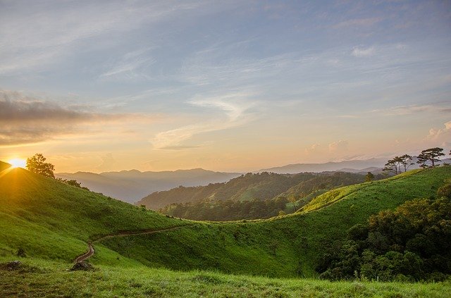
Chopta is a small but beautiful hill station located in the Rudraprayag district of Uttarakhand. The height of Chopta is just 2680 meters (8970 ft) above sea level. This small hill station is very famous mainly because of the Tungnath Temple and Chandrashila Peak. In a way, you can say that Chopta is the base camp of Tungnath and Chandrashila.
Chopta is a meadow area of alpine grass that is surrounded by forests of deodar and rhododendrons on all four sides. This plains area comes under the Kedarnath Wildlife Sanctuary. Being a protected forest area, the surrounding forests of Chopta are home to wildlife like rare musk deer, monal birds, rare fauna found in the Himalayas and pika mouse. Click here to learn more about Chopta.
Tungnath

Tungnath situated at a distance of 04 km from Chopta is the highest altitude temple of Lord Shiva in the world. The height of Tungnath is 3470 meters (11385 ft) above sea level. While trekking the Tungnath Chandrashila Trek, you first reach Tungnath, and then after a 1.5 km trek, you reach the Chandrashila Peak.
Tungnath comes third in Panch Kedar temples, estimated to be more than 1000 years old. It is believed that this ancient temple was built by the Pandavas, because of this some people also believe that the Tungnath temple is more than 5000 years old. Click here to learn more about Tungnath.
Acute mountain sickness

While trekking Chandrashila, you reach an altitude of about 4000 meters. After reaching such a high altitude, many people may start experiencing high fever. Apart from this, you may also feel dizzy after going to high altitude, may have difficulty breathing, may have a headache or may have chest pain. If you feel anything like this then you should stop travelling to the Chandrashila peak at that time.
Or if you are going to some other height, then it should be stopped immediately. And you should gradually move towards a lower altitude. Whenever you are going trekking somewhere you should know about acute mountain sickness. This disease occurs only when you are going trekking to a very high altitude.
Before going to a high-altitude place, you must check with your doctor about acute mountain sickness and take the necessary medicines along with you. If possible, keep a bottle of hot water with you. Oxygen levels are high in hot water, at high altitude places where oxygen is reduced, in such places, you must drink hot water for some time, and your body’s oxygen level will be balanced.
Best Time For Chandrashila Trek
The Chandrashila trek can be completed at any time throughout the year except in January and February. During these two months, there are 8-10 feet of snowfall on the Chandrashila due to which trekking here becomes very dangerous.
If you are not trained to trek in such snow, then you should not trek to the Chandrashila peak in January and February. The best time to trek Chandrashila is considered to be April to June and if you have not been able to trek Chandrashila in these months.
So you can trek Chandrashila from September to October. Before trekking Chandrashila in November and December, you must know how much snowfall there has been. Only after you know the snowfall, if you go for a trek to Chandrashila, then it will be better for you. You should not trek Chandrashila even during the monsoon season, this time it becomes very slippery here.
Stay in Chandrashila – Hotels in Chandrashila
No accommodation is available at the summit of Chandrashila. You will find a campsite and small hotels to stay at in some places close to Chandrashila like Chopta, Duggalbitta, Gopeshwar and Baniyakund.
You can book a room for yourself from Google by taking the number of any hotel here or running the campsite, or you can get a room for yourself by reaching here. There is also a stay arrangement at Tungnath which is very limited.
Chandrashila Local Food

There is no arrangement of any kind of food at the peak of Chandrashila. At both these places Tungnath and Chopta, nearest to Chandrashila, you will find dhabas and small restaurants to eat. Apart from this, some tea stalls are also built between Chopta and Tungnath.
If you want, you can take snacks, biscuits and chocolate with you to the peak of Chandrashila but you should take full care not to spread any kind of dirt on the peak. Before you take the food and food from the dhabas and restaurants made in Chopta and Tungnath, you must know the price of every food item.
Chandrashila Trek – Things you should carry
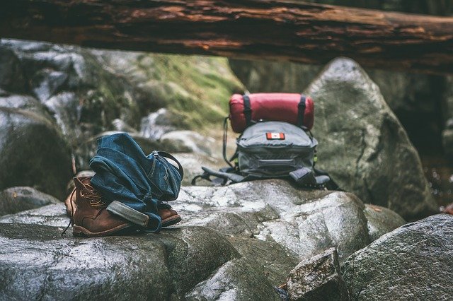
01 full sleeves windproof jacket / down jacket / woollen muffler / warm hat / warm gloves (waterproof gloves)
02 Casual Trek Pants (Do not wear jeans or tight trousers)
03 sleeves t-shirts with collar
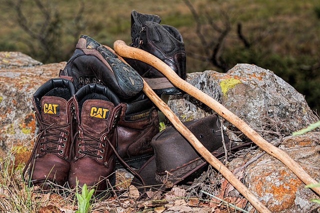
04 Good tracking shoes (to avoid slippery) / sports socks
05 Dressed lightly during the trek
06 Take a poncho or raincoat with you in the rainy season.
07 Small Towel / Sunglasses / LED Flashlight
08 hot water bottle
09 Sunscreen / Moisturizer / Toilet Paper / Crepe Bandage / Lip Balm / Vaseline / Cold Cream
10 medicines – In addition to a band-aid, take medicines for colds, fever, diarrhoea, flu, headache, body pain etc.
Tips for Chandrashila Trek
The Chandrashila trek is considered to be one of the easiest treks in Uttarakhand. But being located at an altitude of 4000 meters, you need to be a little bit healthy. While trekking Chandrashila you will have to travel for the entire 11 kilometres and you should know that you can walk 11 kilometres. More fatigue than climbing is when descending, although it seems less when descending from any height, at that time there is a lot of pressure on your feet, especially on the paws.
Therefore, you have to keep in mind that while trekking Chandrashila it is necessary to be a little physically strong and you must carry the right equipment with you so that you do not have any kind of trouble while climbing and descending. During the winter season, Chandrashila is covered with many feet of snow, trekking at this time is not considered safe at all.
If you are planning to do this trek in January, February and March, then definitely take a trained guide who has come here many times before. Although making a guide will make your trek expenses a bit expensive, due to this, you will also be able to complete the Chandrashila trek safely. Before reaching Chandrashila, you must have an oil-filled car from Ukhimath or Gopeshwar and withdraw money from the ATM.
Because after these two cities, you will neither get a petrol pump nor an ATM. If you are coming from your car, then any of your work related to the car can be done in Ukhimath and Gopeshwar. Before starting the trek, keep a sufficient amount of hot water near you. During the trek, drink water for a while so that your body does not dehydrate and avoid acute mountain sickness.
One warm and one waterproof glove must be kept with two pairs of gloves while travelling. Carry a waterproof bag with you so that your gadgets and extra belongings are protected during the rain. Do not climb at a high speed while climbing, but climb slowly and comfortably, this will reduce fatigue and you will be able to enjoy the trek. If possible, take some snacks to eat with you or you can also eat at the dhabas near Tungnath.
How to Reach Chandrashila in Hindi

How to Reach Chandrashila By Flight in Hindi
The nearest airport to Chandrashila is the Jolly Grant Airport of Dehradun. Dehradun Airport is well connected to major cities of the country. Chandrashila is not connected by any type of road. Chopta is the nearest city to Chandrashila. Chopta is just 179 km from Dehradun Airport (Dehradun to Chopta Distance).
From Dehradun, you can easily reach Rudraprayag by bus. After reaching Rudraprayag, you can reach Chopta by way of Ukhimath or Gopeshwar. If you want, you can reach Chopta from Dehradun very easily by taxi.
How To Reach Chandrashila By Train
If you are planning to come to Chandrashila by rail then Haridwar, Rishikesh and Dehradun railway station is the nearest railway station to Chopta. Regular bus service is available from these three cities to Rudraprayag. From Rudraprayag, you can reach Chopta via Ukhimath and Gopeshwar. If you want, you can reach Chopta by taxi.
Haridwar Railway Station to Chopta Distance – 186 KM
Rishikesh Railway Station to Chopta Distance – 162 KM
Dehradun Railway Station to Chopta Distance – 203 KM
How to Reach Chandrashila By Road in Hindi
Chopta is the motorable road closest to Chandrashila. Although Chopta is well connected by road, there is no direct bus service or public transport service available for this city. To reach Chopta, first of all, you have to reach Rudraprayag. After reaching Rudraprayag, you can reach Chopta via Ukhimath or Gopeshwar. Regular bus services are available from Haridwar, Rishikesh and Dehradun to Rudraprayag.
Rudraprayag to Chopta Distance – 70 KM
Ukhimath to Chopta Distance – 30 KM
Gopeshwar to Chopta Distance – 42 KM
Travel Tips
01 Chopta is well connected by road to almost all the towns of the Garhwal region of Uttarakhand state.
02 Chopta is not directly connected to Rishikesh, Haridwar and Dehradun by any form of transport. You have to reach Rudraprayag first and after that, you can reach Ukhimath or Gopeshwar from Rudraprayag and reach Chopta by taxi.
03 You can also reach Chopta through your private vehicle.
04 If you find Chopta on Google map, then Google shows you the location of Chopta village which is not a hill station. If you type Chopta Hill Station on Google Maps, Google will show you the correct location on Chopta’s map.
05 Road Map of Chopta – Delhi – Roorkee – Haridwar – Rishikesh – Devprayag – Srinagar – Rudraprayag (Kedarnath Road) – Agastamuni – Kund (turn left for Ukhimath before the bridge) – Ukhimath Cut (go straight for Chopta) – Mastura – Makku Bend (holding road leading to Chopta) – Duggalbitta – Baniyakund – Chopta
Tourist places near Chandrashila
Chopta, Tungnath, Rudraprayag, Kedarnath, Badrinath, Gangotri, Yamunotri, Rudranath.
(If you have reached here in this article, then I have a small request from you to share your suggestions related to this article in the comment box below, and if you see any deficiency or any wrong information, then also definitely Tell me. I keep posting information related to travel on this website, if you like the information given by me, then you must subscribe to my website through your email, thank you).


